- Details
- Written by Peter Miller Peter Miller
- Published: 02 September 2012 02 September 2012
- Hits: 29000 29000
For the radio show related to this page see: http://kboo.fm/node/49212 on KBOO 90.7 FM.
The Palestine Land Loss cards are available at http://www.fosna.org/content/mapcards
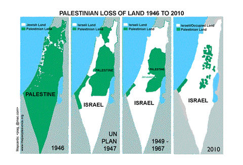
The Land Loss card quickly illustrates the basic political history of the Palestine-Israel conflict. The first panel shows the relative land Jewish and Palestinian land ownership just prior to the creation of the State of Israel in 1948. Jews at that time owned about 7% of the land, represented by the white areas on the first panel, and about 30% of the total population of Palestine. The second panel shows the U.N. partition plan of 1947 which gave the Jewish population about 55% of historic Palestine. The third panel shows the situation after the creation of the state of Israel, which involved the ethnic cleansing over 700,000 Palestinians from their land and the destruction of hundreds of Palestinian villages and towns. Israel was created on 78% of historic Palestine with only 22% for Palestinians in the West Bank and Gaza. This panel also represents the basic outline of a viable two-state solution. The fourth panel represents the situation we face today: the Palestinian Gaza strip is under a cruel and permanent siege and closure and the Palestinian areas in the West Bank becoming isolated islands in a sea of Israeli control as Israel continues to annex and expand its control over Area C.
This United Nations OCHA map of Area C shows in better detail the Israeli controlled Area C which Israel is on the verge of annexing. It represents over 65% of the West Bank.

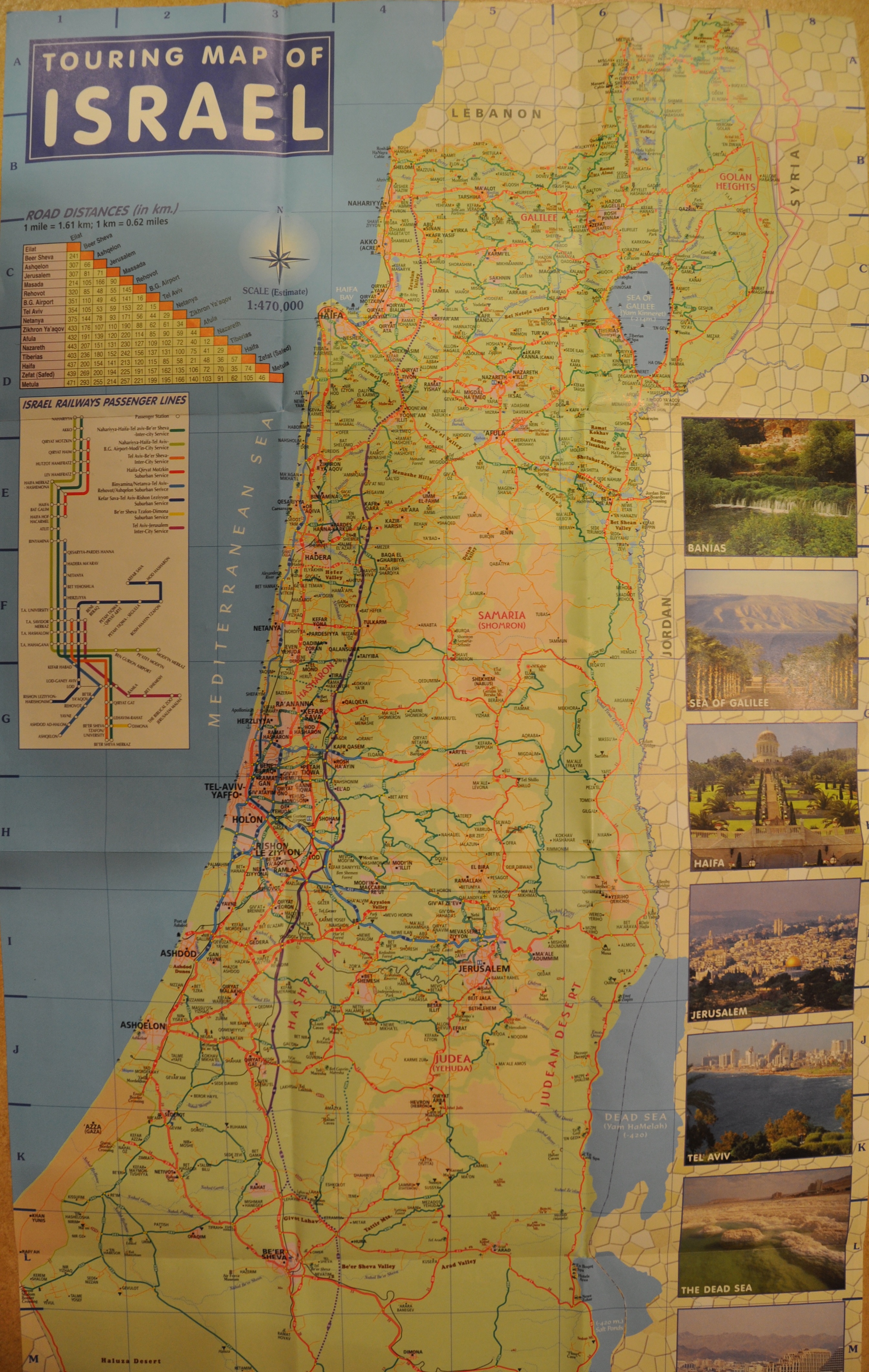
This is the Touring Map of Israel that you can get at any Israeli tourism office. This represents the official Israeli view of what is Israel. You can easily see that it matches the UN map above and the Palestinian land loss map at the top of the page. Except, of course, it doesn't show a West Bank at all and doesn't list Area C as separate from Israel at all. On this map, visitors to the Palestinian Areas A and B are warned to consult with the appropriate authorities before entering. Click on it for full size:
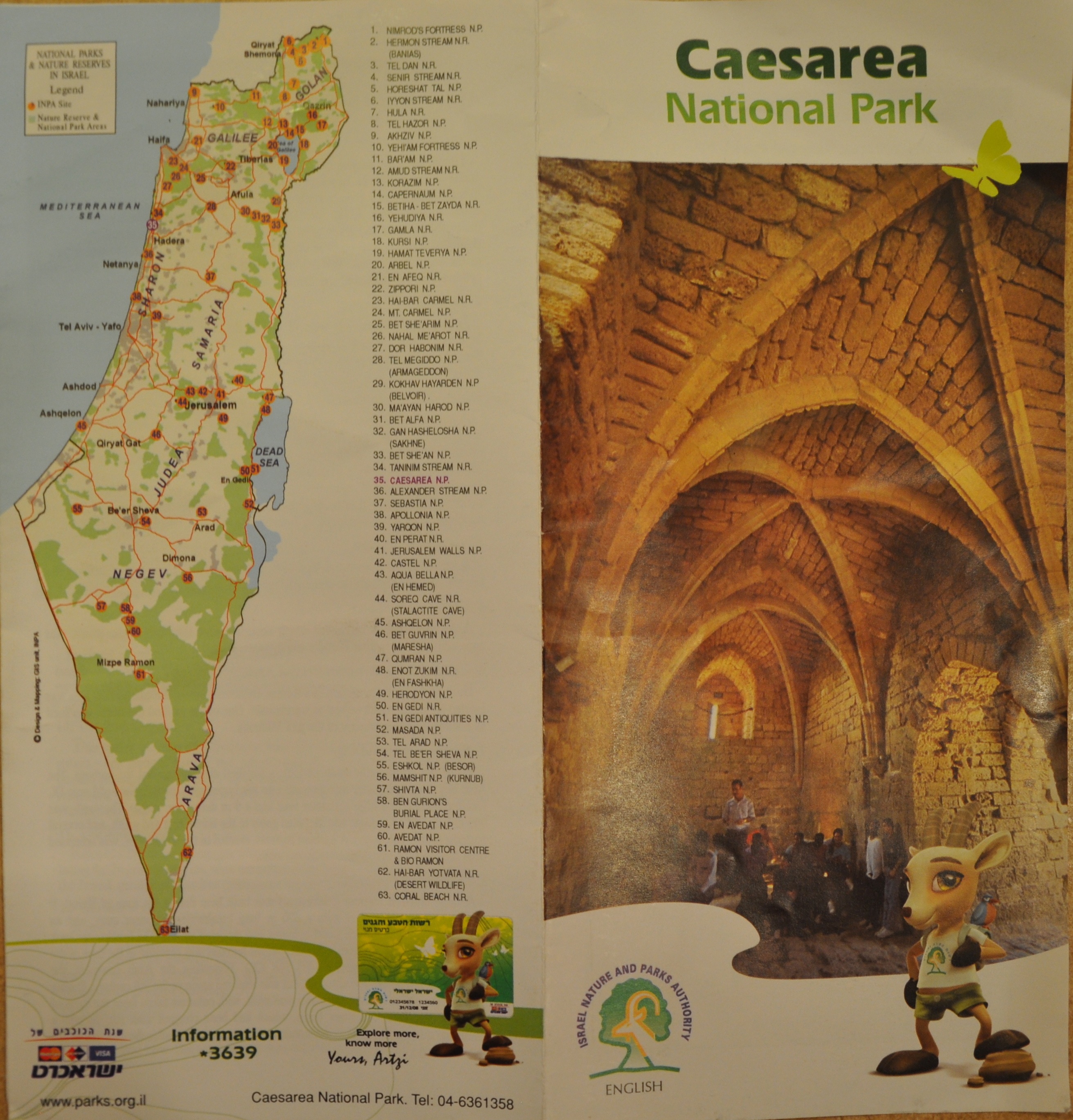
This is an Israeli National Park map for Caesarea. All the Israeli National Park maps follow this basic format: No Palestinian West Bank is depicted and no Palestinian towns or cities are shown. There is no Palestine on this map, only Israel. Not only that, it shows as Israeli national park land territory that is deep within the Palestinian West Bank. Click on map for full size:
Here is the Audio of Eid Jahalin being interviewed by Angela Godfrey-Goldstein:
docs/paltrip2012/Audio27J8-JahalinBedouin-AngelaGodfrey-Goldstein-EidJahalin-C48.mp3
docs/paltrip2012/Transcript-Jahalin-Bedouin.pdf
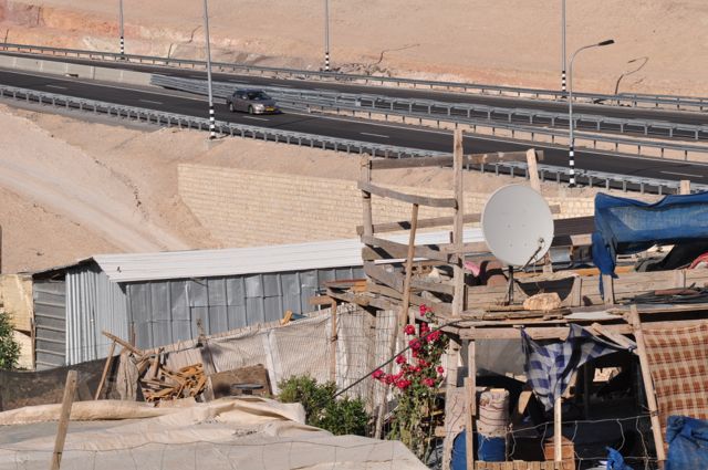
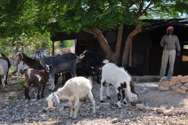
The Jahalin Bedouin Village:


The Jahalin School. Built of old car tires retrieved from a dump and mud, this school allowed children to get an education without crossing the dangerous highways and traveling, often on foot, up to 22 kilometers. Immediately after the school was built, the Israeli government issued demolition orders to destroy the school. The school also suffers from harassment and intimidation from settlers from the nearby settlements.
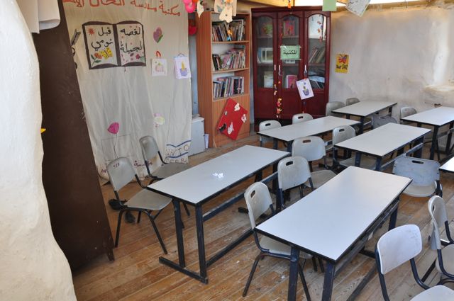
Inside a classroom.
Water fountain outside a school building,the car tires used in construction are clearly visible:

Here is the audio of Daoud Nassar talking to a group on a Sabeel fact-finding trip:
docs/paltrip2012/Audio37J15-TentOfNations-Daoud-DaherNassar-C48.mp3
docs/paltrip2012/Transcript-TentOfNations-DaoudNassar.pdf

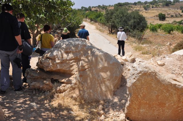
The road to the Tent of Nations has been blocked with large boulders by the Israeli military . . .
This is the sign you see when you are about to cross from Israeli controlled Area C in the West Bank into the Palestinian Areas A and B. It warns Israeli citizens that it is illegal to enter into these areas. This keeps the two peoples separated and limits contact and the opportunities for dialogue and meeting. It is said that newer versions of this sign are in Hebrew only, so that the rest of us won't understand the import.

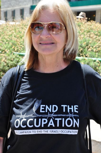
Jeff and Shoshana Halper at a Women in Black protest in Jerusalem.
